~ Essex & Suffolk ~ Sea Charts, Town Plans & Maps ~
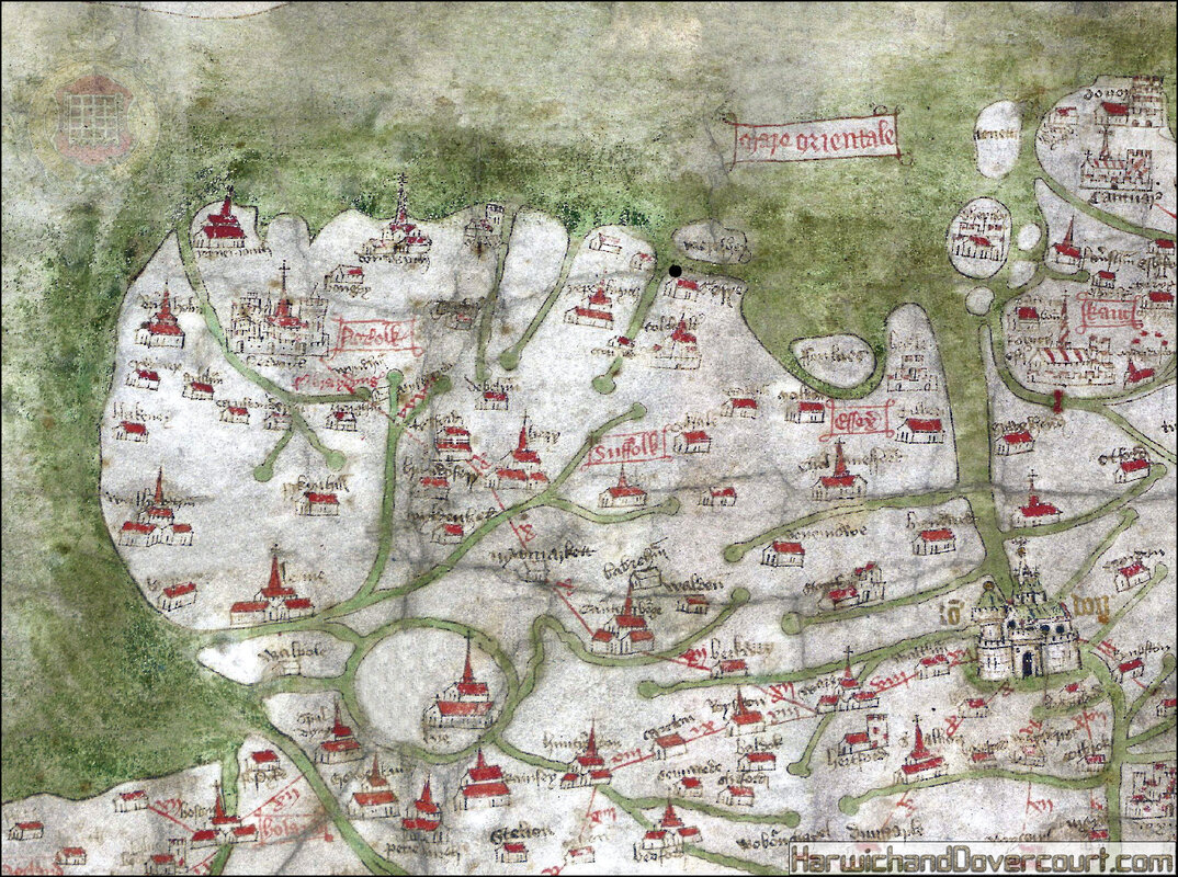
~ 1360 ~ Gough Map of Essex & Suffolk H&D FW ~
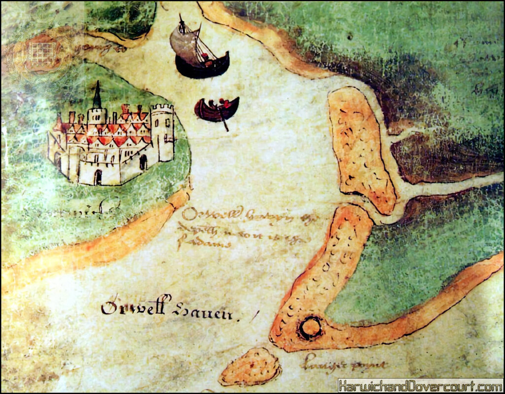
~ 1500 ~ Early Harwich Chart (16th Century) H&D FW ~
~ 1543 ~ Plan of the River Orwell and Haven by Richard Lee H&D FW ~
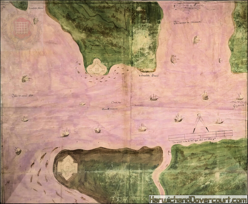
~ A Plan of Orwell Haven by Richard Lee, 1543 (ink & tempera on parchment) ~
~ 1545 ~ A Buwark (Defences) at Harwich H&D FW ~
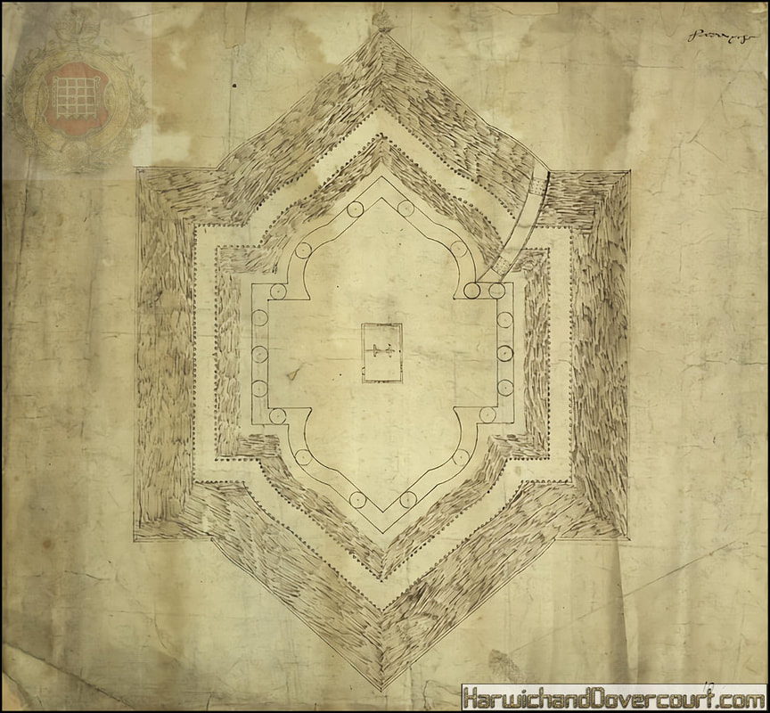
This is a plan of a bulwark at Harwich dating from around.1540-1550.
At this time Harwich was a port of some consequence. The threat posed to England by the combined enemy forces of France and Spain after Francis I of France, and Charles V Holy Roman Emperor and King of Spain signed a peace treaty in 1538, led to a program of coastal defence. In 1539 the government encouraged the town in its endeavours to strengthen the medieval town walls of Harwich.
A visit by the King in the summer of 1543 was followed by a decision to fortify Harwich further. Three bulwarks were built at Harwich, like the others in Essex they were not permanent structures of stone but were described by Edward VI in his journal as ‘bulwarks of earth and board’. The plan shows that these structures were symmetrical moated enclosures with earthen ramparts supplemented by rows of large round baskets filled with earth known as ‘maunds’ which, in the 16th century warfare ere used to protect gun crews in the field. Here cannons are shown between the baskets. Richard Lee and Richard Cawarden, the Dean of Chichester together received a total of £1300 from the Court of Augmentations for works variously described as ‘the king’s fortresses at harwich’ ‘fortifications at Harwich and St. Osyth’s’ and ‘the waterworks at harwich’. Lee and Cawarden were to also work on the major works at Portsmouth. Lee was employed as surveyor and Carwarden was most likely to have been the paymaster. Each bulwark had a captain, a lieutenant, a porter, 2 soldiers and 3, 4 or 6 gunners. In October 1552 it was decided that the garrisons should be discontinued for the sake of economy.
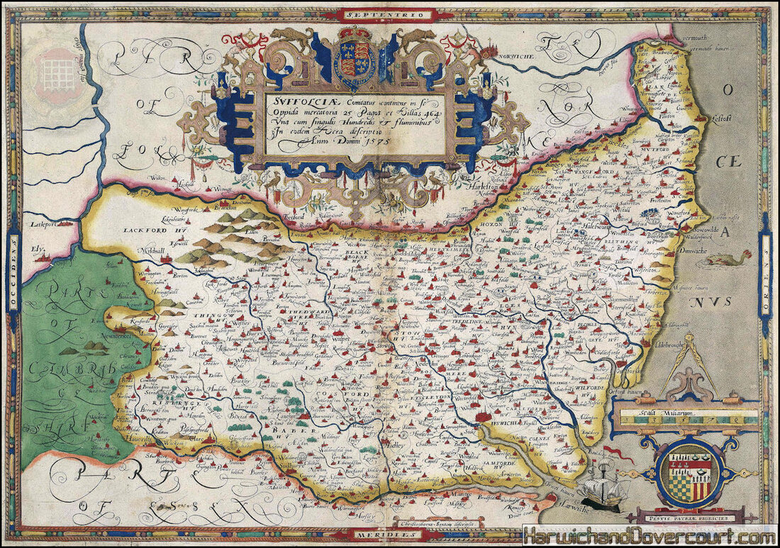
~ 1575 ~ Saxton Suffolk Map H&D FW ~
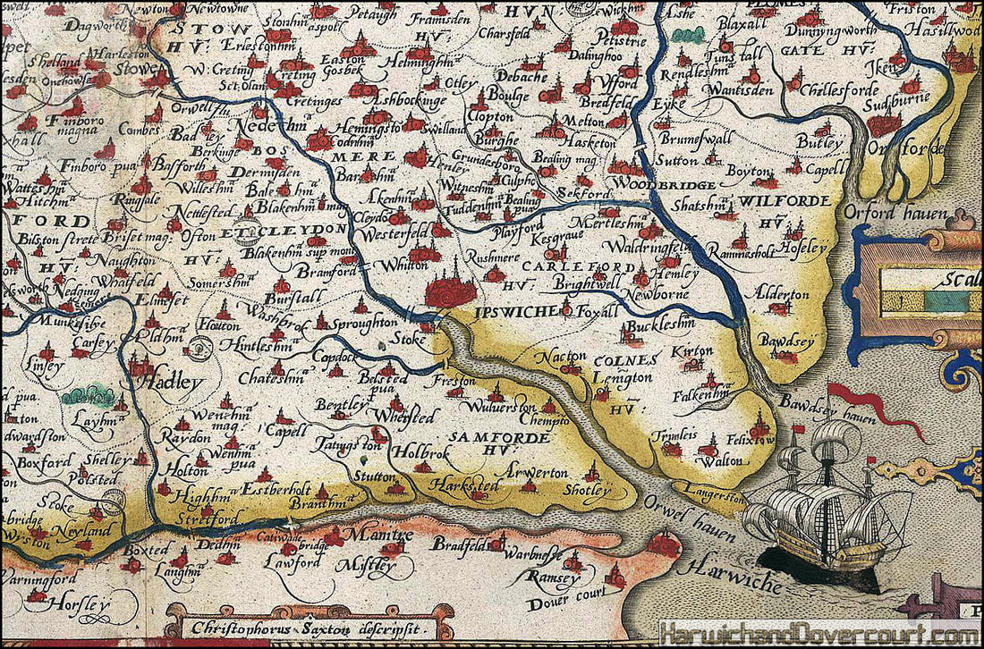
~ 1575 ~ Saxton Suffolk Map H&D FW ~ Detailed area of North East Essex ~
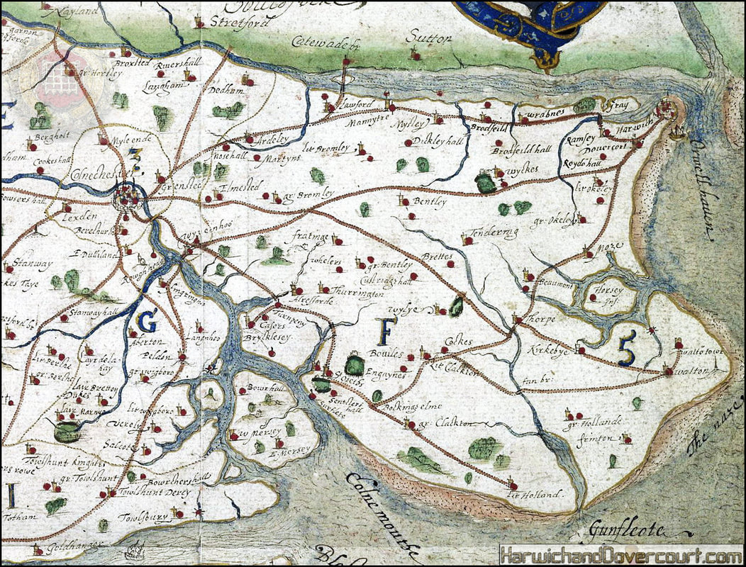
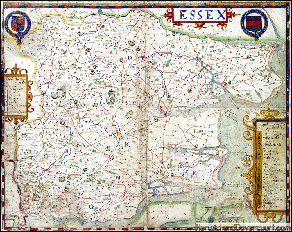
~ 1576 ~ Early Map of Essex (Saxton) H&D FW ~
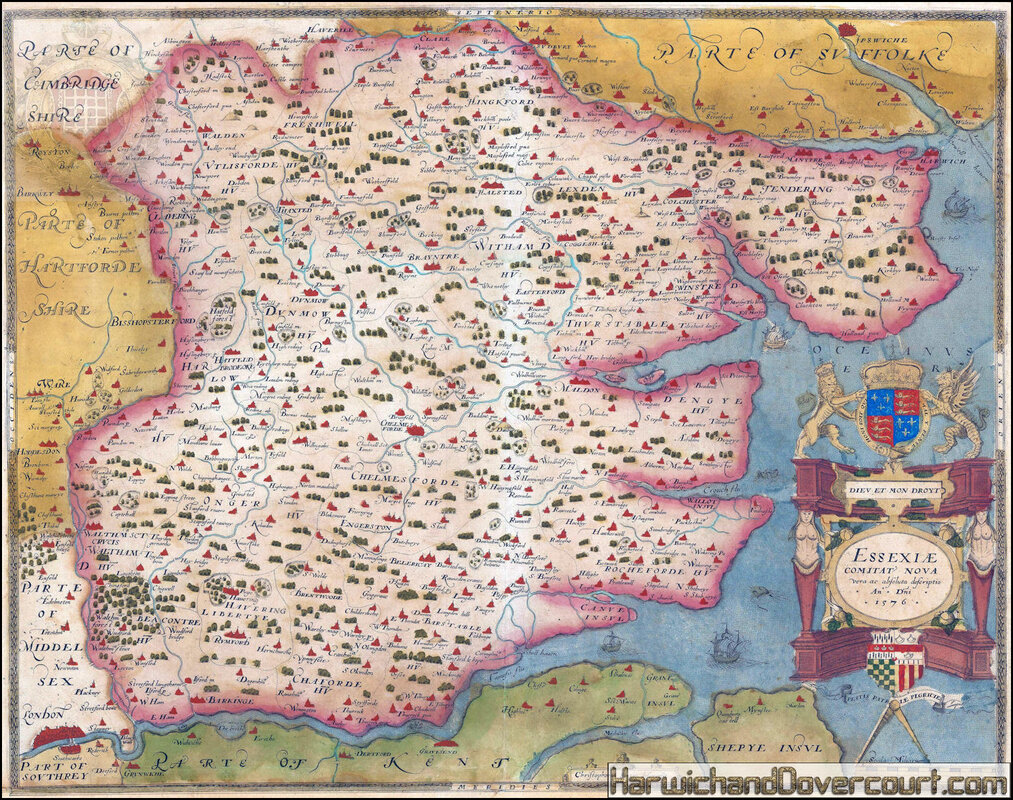
Christopher Saxton , 1576
Essexiae Comitat' Nova Vera ac Absoluta Descriptio
The first printed map of Essex. Engraved in 1576 and published in the first English county atlas, Saxton's "Atlas of the Counties of England and Wales", in 1579. Original hand colour.
Modelled on Abraham Ortelius's atlas, the world's first, "Theatrum Orbis Terrarum", inspired Yorkshireman Christopher Saxton (1542? - 1610?) created and compiled an atlas of English county maps between 1570-78. The atlas was commissioned and funded by Thomas Seckford, a court official and Master of Requests for Queen Elizabeth I. As such, the title cartouche on this map has the Royal Arms belonging to the Queen, mounted atop of it.
The map was first engraved in 1576 for a composite atlas belonging to William Cecil Lord Burghley, Elizabeth I's Secretary of State (This 1576 copy exists within the British Library's collection). Later editions of this map, engraved date of 1642, published from 1645 by William Web, including such alterations as to include an English title rather than Latin and an inset town plan of Essex.
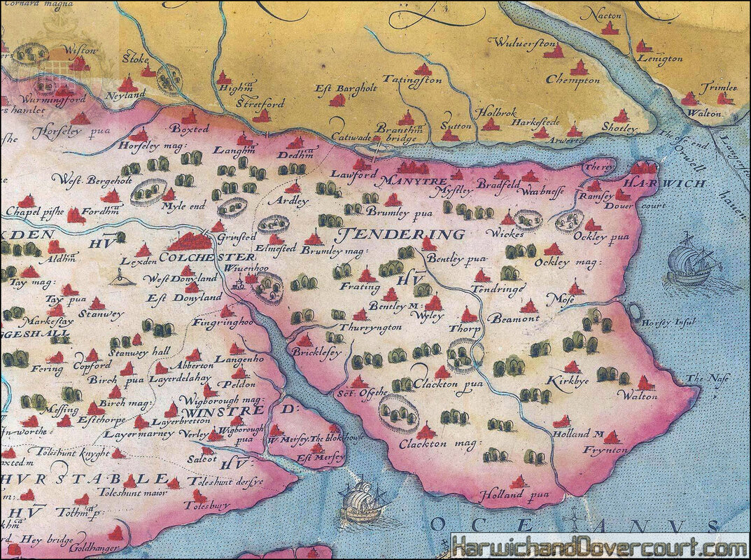
~ 1576 ~ Early Map of Essex (Saxton) Tendering H&D FW ~ Detailed area of North East Essex ~
~ 1594 ~ John Norden Map Of Essex H&D FW ~
~ 1594 ~ John Norden Map Of Essex H&D FW ~ Detailed area of North East Essex ~